To the navigation Skip to main content To the footer
Top

Latemar.Art, union between art and nature

Tesero
Category
Difficulty
Easy
Duration
1:00
in hours
Distance
2.5
in km
Suggested period
Jan
Feb
Mar
Apr
May
Jun
Jul
Aug
Sep
Oct
Nov
Dec

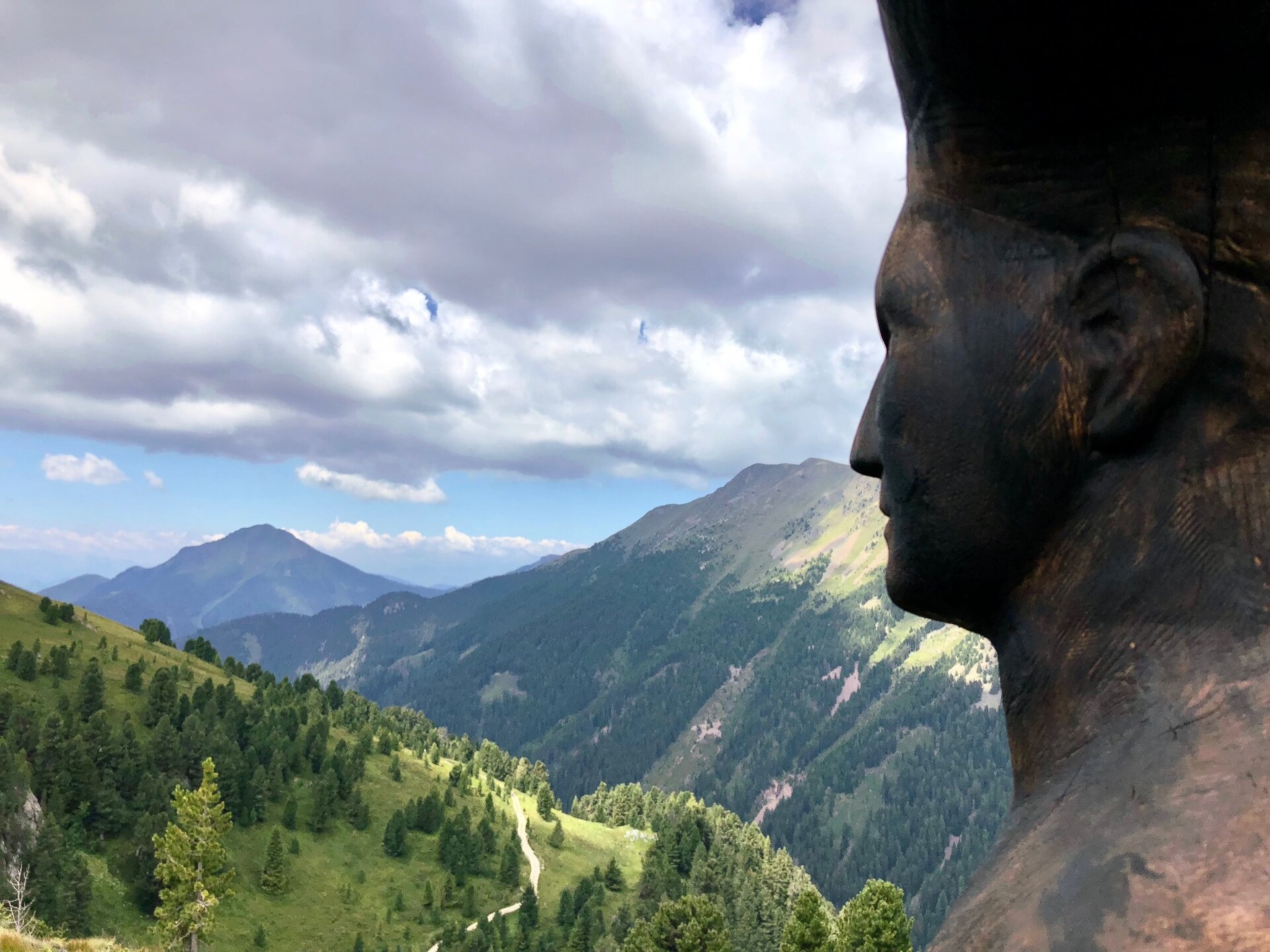
It is called RespirArt and it is one of the highest art parks in the world. It winds between 2,000 and 2,200 meters in Pampeago, in Val di Fiemme, at the foot of the Latemar Dolomites.

The art park "RespirArt" is a green gallery constantly developing. Artists from all over the world come to the park and create Land Art works inspired by the surrounding Dolomite landscape. New installations are added every summer, while the older ones change according to weather conditions, or are destroyed by the weight of the snow. This is how the works, created with natural elements, return to nature.

Further information and useful links

APT Val di Fiemme - Tel. +39 0462 241111 - info@visitfiemme.it - www.visitfiemme.it 

Ski Center Latemar - Tel. +39 0462 813265 - info@latemar.it - www.latemar.it 

www.respirart.com 

Tags
  • Scenic
  • Round trip
  • Refreshment stops available
  • Cultural/historical interest
  • Cableway ascent/descent
Route data
Easy
Distance
2,5 km
Duration
1 h 00 min
Ascent
165 m
Decent
165 m
Physical condition
Scenary
Highest point
2.177 m
Lowest point
2.012 m
Suggestions

Visit the art park also in winter on skis! The Agnello slope runs right next to the most representative works!

You might be interested in
Discover related tours
Pine walk | © N. Delvai, APT Fiemme Cembra
Easy
Ville di Fiemme
Carano - The pine walk
Distance 4,0 km
Duration 1 h 20 min
Ascent 140 m
Decent 140 m
© Sara Zucal, Rete di Riserve Val di Cembra Avisio
Faver, Grauno, Grumes, Valda, Capriana, Cembra, Lisignago
Botanical Nature Trail on the Dossone di Cembra
Distance 25,8 km
Duration 9 h 00 min
Ascent 1.095 m
Decent 1.138 m
Alpine meadows | © Staff Outdoor Val di Fiemme, APT Fiemme Cembra
Easy
Ville di Fiemme
Easy walk to Malga Gurndin and Isi Hütte
Distance 6,9 km
Duration 2 h 00 min
Ascent 160 m
Decent 160 m
© Sara Zucal, Rete di Riserve Val di Cembra Avisio
Intermediate
Giovo
At Roccolo del Sauch, passing through Malga Monte Alto
Distance 8,3 km
Duration 2 h 40 min
Ascent 323 m
Decent 321 m
© Rete di Riserve Val di Cembra Avisio
Intermediate
Sover
Pasture at the foot of Mt. Lagorai
Distance 11,0 km
Duration 4 h 30 min
Ascent 700 m
Decent 700 m
© Syrio, Creative Commons
Valfloriana
Valfloriana’s small villages
Distance 11,2 km
Duration 4 h 30 min
Ascent 650 m
Decent 650 m