To the navigation Skip to main content To the footer
Top

The Segonzano Pyramids trail

Segonzano
Difficulty
Easy
Duration
2:30
in hours
Distance
3.9
in km
Categories
  • Mountain tour
Tags
  • Geological highlights
  • Round trip
  • Refreshment stops available
  • Family-friendly
Suggested period
Jan
Feb
Mar
Apr
May
Jun
Jul
Aug
Sep
Oct
Nov
Dec

An itinerary exploring a rare and fascinating geological phenomenon, the “òmeni de Segonzan”

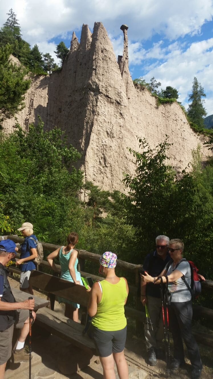
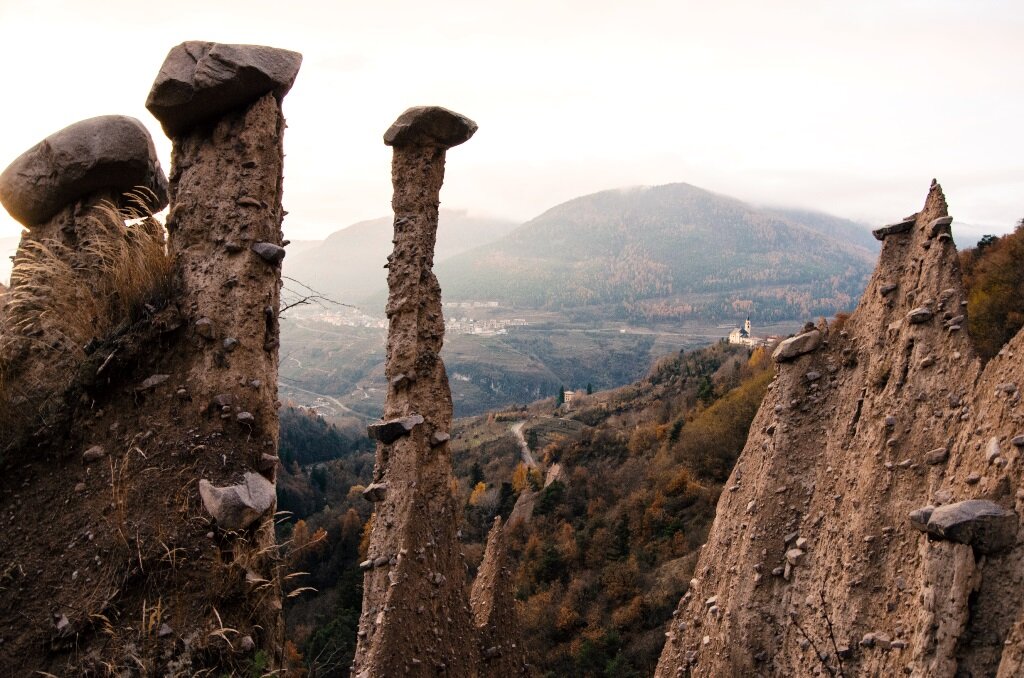
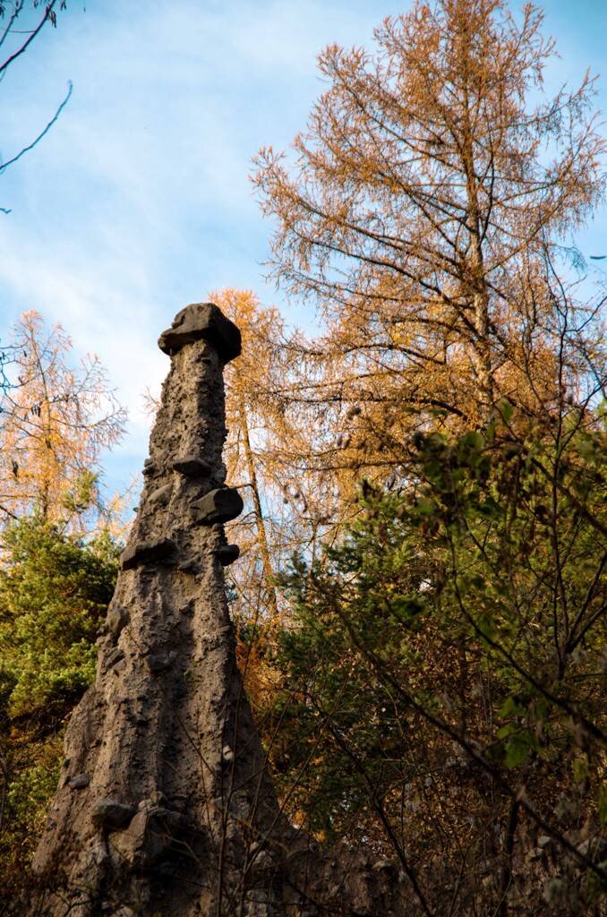
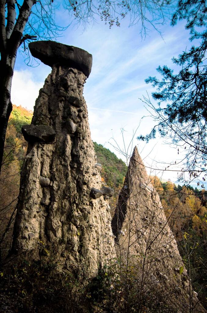
This route explores one of the Trentino’s most fascinating geological phenomena: the Segonzano earth pyramids, spectacular ‘natural sculptures’ resulting from the action of rain water on ancient glacial deposits. When the porphyry blocks contained in these deposits are brought to the surface by erosion, these may act as ‘roofs’ to the material underneath, protecting them from rainwater and thus generating singular pyramids with ‘hats’ on. If these hats fall off the pyramids quickly fall down. Locally called òmeni’ de Segonzan – the Segonzano ‘men’ – they are thus an ephemeral phenomenon.
Gallery
Further information and useful links

Rete di Riserve Alta Val di Cembra-Avisio

www.reteriservevaldicembra.tn.it

Visit Trentino

www.visittrentino.info

Meteotrentino

www.meteotrentino.it

Categories
  • Mountain tour
Tags
  • Geological highlights
  • Round trip
  • Refreshment stops available
  • Family-friendly
Route data
Easy
Distance
3,9 km
Duration
2 h 30 min
Ascent
300 m
Decent
300 m
Physical condition
Scenary
Highest point
860 m
Lowest point
599 m
Suggestions

The trail is steep and south-west oriented. Therefore, we strongly suggest to avoid the central and the warmest daytime hours.

Once reached the hamlet Stedro its narrow streets deserve a visit before going back.

In the summer using the footpath requires buying a ticket costing a few euros.

You might be interested in
Discover related tours
Rifugio Lusia | © A. Campanile, APT Fiemme Cembra
Intermediate
Predazzo
Passo Lusia
Distance 9,3 km
Duration 3 h 30 min
Ascent 510 m
Decent 510 m
© Federico Monegatti, APT Trento
Intermediate
Cembra, Lisignago
To the 'Piz delle Agole' and the little church of S. Leonardo
Distance 10,8 km
Duration 4 h 45 min
Ascent 660 m
Decent 661 m
© Alessandro Cristofoletti, APT Trento
Intermediate
Faver, Grauno, Grumes, Valda, Cembra, Lisignago, Giovo
Trekking of the ancient lakes - Day 1
Distance 18,3 km
Duration 7 h 00 min
Ascent 1.141 m
Decent 397 m
Cauriol summit cross | © A. Campanile, APT Fiemme Cembra
Difficult
Ziano di Fiemme, Predazzo
Cima Cauriol: a symbol of the First World War
Distance 14,5 km
Duration 6 h 00 min
Ascent 990 m
Decent 990 m
Panorama of the Avisio from the Botanical Path between Grauno and Capriana | © Sara Zucal, Rete di Riserve Val di Cembra Avisio
Easy
Capriana, Faver, Grauno, Grumes, Valda
Naturalistic botanical footpath
Distance 11,8 km
Duration 4 h 30 min
Ascent 300 m
Decent 300 m
The Venetian sawmill seen from the outside | © Stefano Campo, Rete di Riserve Val di Cembra Avisio
Intermediate
Faver, Grauno, Grumes, Valda
The Sentiero dei Vecchi Mestieri – from Grumes
Distance 5,3 km
Duration 3 h 00 min
Ascent 400 m
Decent 400 m
Status
open